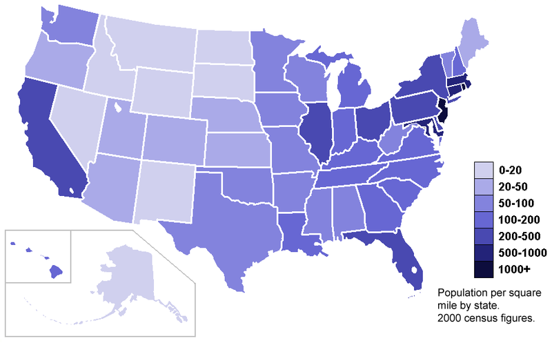
Here is an example of a standardized choropleth map, where data is averaged according to land area. This is useful because of how maps can be skewed because of the modifiable area unit problem. These maps are commonly used to show population over area like the map above which shows this data for the US.
URL: https://blogger.googleusercontent.com/img/b/R29vZ2xl/AVvXsEh07QDhFjstiVjvuRoxArft4hJMNk_B-rQ38OWFvHmOYvjGSibaQG1YRMtBICbTfUoODMXMW5LgzwSDIP1_kVkGwo6vxcm7L6RUM1Jewpo5YPNkGtGyCbC_Xj9uVPphUQPSC_T3ofFfxVU/s1600/standardized+c+map.PNG
No comments:
Post a Comment