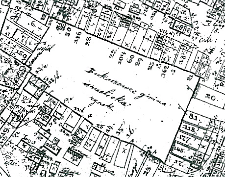
This is a cadastral map. Cadastral maps are representations of property ownership. They allow us to understand and accurately determine boundaries between the properties of different owners, mitigating boundary disputes between neighbors for example. These maps were first used by the ancient Egyptians. Modern maps often integrate information such as GPS coordinates to be highly accurate. The above map is a cadaster of a market square in the Ukraine and is being used by researchers studying Jewish ownership of the stores here!
URL: http://www.geshergalicia.org/wp-content/uploads/2011/02/BukachivtsiJewishMarketSquare.jpg
No comments:
Post a Comment